GEOGRAPHY, RECTANGLES 2,3 and 4
2.- THE EARTH The Axis is the imaginary line that goes from the North Pole to the South Pole. The Equator is the imaginary line that goes around the middle of the Earth. Northern Hemisphere is the northern half part of the Earth. Southern Hemisphere is the southern half part of the Earth. |
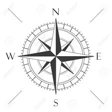
3.- THE CARDINAL POINTS There are four cardinal points: North (N), south (S), east (E) and west (W). There are also four intermediate points: North-east (NE), south-east (SE), north-west (NW) and south-west (SW). Remember that the east is where the sun rises every morning!! |
4.- STREET MAPS AND PLANS 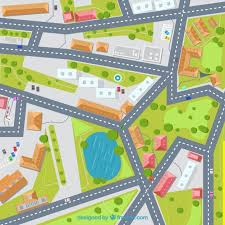 A street map is a small representation of a town or city. It shows streets, parks and the most important places using symbols . It’s divided into squares and uses a scale: 1cm=10m) A plan represents a room or a building. It also has a scale. 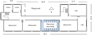 |
0 comentarios